Available with Business Analyst license.
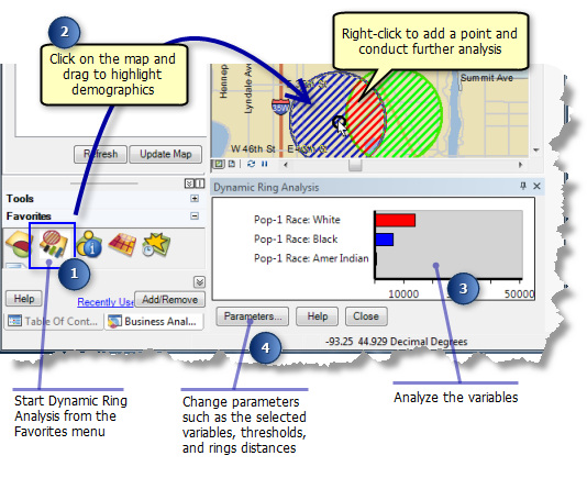
The Dynamic Ring Analysis tool allows you to pan over the map and evaluate site locations using a value you set as a threshold. You can also view a chart with a number of variables that are summarized within the area of the dynamic ring. The chart is dynamically updated as you move the mouse pointer around the map.
You have the option of defining a threshold field and threshold value. If you do, the dynamic ring will be red in the areas where the threshold value is not exceeded and green in the area where the threshold value is met. This feature allows quick and obvious screening of possible site locations that meet your target criteria.

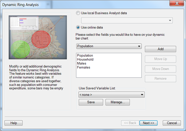
In version 10.2 GeoEnrichment functionality (the ability to use ArcGIS Online Data) was added to this tool.
To enable this functionality select "Use online data" in the Dynamic Ring Analysis wizard (as seen below).
