Available with Production Mapping license.
The product library allows the organization of ArcMap documents (.mxd) and other files used in production, such as source data and exported files. These files are stored in relation to your working environment. When you are setting up your product library, you can configure the structure by creating a solution, product class, series, product, instance, and area of interest.
Defining the structure of the product library
The product specifications and the data you are working with help determine the structure of your product library. When you take these into consideration, you can decide how to best organize your map documents and their related components. Other factors that need to be considered include the following:
- The type of maps and data you are generating
- The purpose of your maps and data
- The way you want to group documents
- Geometries for your areas of interest
Below are two examples for defining a product library. The first example reflects a structure based on a project, while the second reflects a structure that is based on one of the ArcGIS Mapping and Charting solutions.
Example 1: Organizing maps based on a project
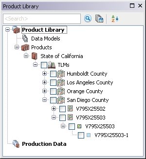
In this example, the solution name is the name of the project on which you are working, and the product class name matches the type of hard-copy map you are producing. Series are created based on the individual counties within the state, and maps are created based on an index of TLMs.

Example 2: Using a solution to define the product library structure
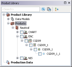
When you are using a solution as the base for the product library, the name of the solution component in the product library matches the name of the solution you are using. The product class name corresponds with the type of chart that is being created. The series name is a subgroup of the product class that further defines the type of chart you are creating, provided it is for a single area. All the applicable charts for the area are then created within that series at the product level.
