Available with Standard or Advanced license.
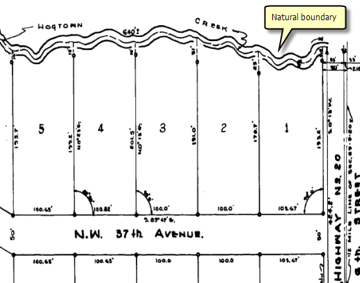
A natural boundary is a parcel boundary that is formed by a natural feature. The most common example of a natural boundary is the bank of a river bed.

In the parcel fabric, natural boundaries are referred to as line strings and can be created using the Line String  located on the Parcel Details dialog box.

- In an edit session in ArcMap, create a new parcel and begin traversing in your parcel lines.
- To traverse in the natural boundary, click the Line String
 tool on the Parcel Details dialog box and begin digitizing in your natural boundary.
 - If the line string does not end on an existing parcel point, right-click and click Finish Digitizing to finish digitizing the line string.
- To edit a line string, click the Bearing field of the line string row in the Lines grid and click the Line String tool on the Parcel Details dialog box.
To create a new parcel with a natural boundary, follow these steps:
All segments digitized are represented as a single line string in the lines grid.
Vertices will become visible on the line string parcel boundary. You can click a vertex to drag the vertex and modify the line string shape.

You can also right-click the line string to add vertices and delete vertices.