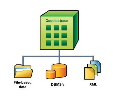
The geodatabase employs a multitier application architecture by implementing advanced logic and behavior in the application tier on top of the data storage tier (managed within various database management systems, files, or extensible markup language [XML]). The geodatabase application logic includes support for a series of generic geographic information system (GIS) data objects and behaviors such as feature classes, raster datasets, topologies, networks, and other advanced functionality.

Responsibility for management of geographic datasets is shared between the ArcGIS software and database management system or files. Certain aspects of geographic dataset management, such as disk-based storage, definition of attribute types, associative query processing, and multiuser transaction processing, are delegated to the database management system in the case of enterprise geodatabases. The GIS application retains responsibility for defining the specific schema used to represent various geographic datasets and for domain-specific logic, which maintains the integrity and utility of the underlying records.
In effect, the database management system is used as one of a series of implementation mechanisms for persisting geographic datasets. However, the database management system or file structure does not fully define the semantics of the geographic data. This could be considered a multitier architecture (application and storage), where aspects related to data storage and retrieval are implemented in the data storage tier as simple tables, while high-level data integrity and information processing functions are retained in the application and domain software (ArcGIS).
The separation of geodatabase logic from storage enables open support for numerous file types, database management systems, and XML. For example, access to almost any feature and tabular data format is provided by the Data Interoperability extension to ArcGIS. This extension provides a gateway to read and work with dozens of data formats using the geodatabase logic.