This document is archived and information here might be outdated.  Recommended version.


IRgbColor Interface (ArcObjects .NET 10.8 SDK)
ArcObjects Help for .NET developers > ArcObjects Help for .NET developers > ArcObjects namespaces > Display > ESRI.ArcGIS.Display > Interfaces > IR > IRgbColor Interface
ArcGIS Developer Help

IRgbColor Interface

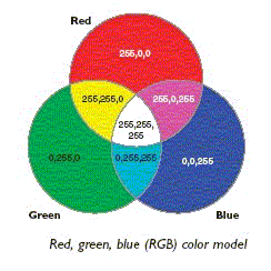
Provides access to members that control the RGB color values.

Product Availability

Available with ArcGIS Engine, ArcGIS Desktop, and ArcGIS Server.

Description

IRgbColor maintains information about a Color by using the RGB (Red, Green, Blue) color model.

Members

Name Description
Read/write property Blue The blue component of an IRgbColor (0-255).
Read/write property CMYK The CMYK value of color.
Method GetCIELAB The CIELAB value of color.
Read/write property Green The green component of an IRgbColor (0-255).
Read/write property NullColor Indicates whether this color is null.
Read/write property Red The red component of an IRgbColor (0-255).
Read/write property RGB The RGB value of color.
Method SetCIELAB The CIELAB value of color.
Read/write property Transparency The Alpha Blending value. (0 for transparent, 255 for opaque).
Read/write property UseWindowsDithering Indicates if colors should be dithered to simulate colors that aren't supported by the display. This only applies on displays that have 256 or fewer colors.

Inherited Interfaces

Interfaces Description
IColor Provides access to members that control the basic color interface.

Classes that implement IRgbColor

Classes Description
RgbColor A color in the RGB(Red Green Blue) color system.

See Also

IHlsColor Interface | IGrayColor Interface | IRgbColor Interface | IHsvColor Interface

.NET Samples

Use an AlgorithmicColorRamp to color a ClassBreaksRenderer Angle Angle shape constructor Move a graphic along a path in ArcMap Create a custom default raster renderer Create a custom default raster catalog renderer Create a custom tool Custom UI elements using add-ins Editing using a custom form Effects in the GlobeControl 3D dynamic element tracking Creating a toolbar of globe tools Executing geoprocessing tools in the background Draw text on a MapControl Geoevents in a MapControl Building a MapViewer application using the ArcGIS Engine controls 3D multipatch examples Multivariate renderer Add a traversal result to the map ArcGIS Network Analyst extension barrier location editor Use a PageLayoutControl as an overview window RSS weather GraphicTracker RSS weather layer Implementing a schematic digitizing tool Add and symbolize a historical temporal layer in ArcMap Play back tracking data Custom feedback tool and font drop-down list tool control