 |
This document is archived and information here might be outdated. Recommended version. |
 |
This document is archived and information here might be outdated. Recommended version. |
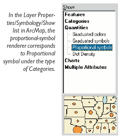
A proportional symbol renderer, used to draw symbols of varying size for each feature, sized in proportion to a field value.
Use this renderer to represent quantitative data for features. With this renderer, symbol size is exactly proportional to the data value.

| Interfaces | Description |
|---|---|
| IBarrierProperties2 | Provides access to members that control how objects (text, features, graphics) act as barriers for labelling with the cancel tracker. |
| IDataExclusion | Provides access to members that control the exclusion of data values from a renderer. |
| IDataExclusion2 | Provides access to members that control the exclusion of data values from a renderer. |
| IDataNormalization | Provides access to members that control the data normalization properties of a renderer. |
| IExportSupport | Provides access to export support members. |
| IFeatureRenderer | Provides access to members that control functionality common to all feature renderers. |
| ILegendInfo | Provides access to members that control legend information provided by a renderer. |
| IPersist (esriSystem) | |
| IPersistStream (esriSystem) | |
| IProportionalSymbolRenderer | Provides access to members that control the drawing of varying size symbols for each feature, each sized in proportion to a field value. |
| IRotationRenderer | Provides access to members that control the drawing of rotated marker symbols based on field values. |
| IRotationRenderer2 | Provides access to members that control the rotation of marker symbols based on field values, expression, or random. Used for all symbols, not just 3D; used for all apps, including ArcMap. |
An example of using the proportional-value renderer is where you have map tree locations as points and an attribute reflecting the radius of the tree canopy. By using proportional circles, the trees can be depicted by circles reflecting theactual ground covered by the tree.
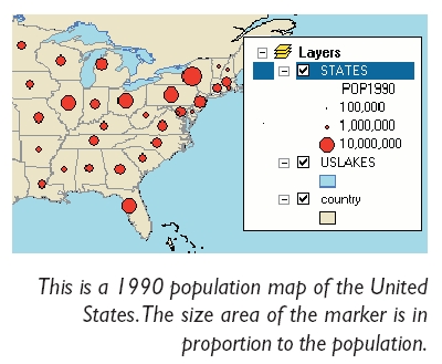
Another application is a population map; the area of a circular marker can directly relate to the population value.

Proportional symbols also apply well to line symbology; a river could be symbolized with a network of lines with different widths reflecting the river flow.
Known vs. Unknown Data Units
There are really two uses of proportional symbol rendering:
First, you can have a data field that represents an actual distance in the real world, such as the radius of a tree canopy in meters, or the width (actually diameter) of a water main in inches. In this case your units are known and you can use a ProportionalSymbolRenderer to draw a symbol on your map for each feature such that the area occupied by the feature on the map represents the actual area occupied in the real world.
Second, you may have a data field that represents a non-distance quantitiy, for example you might have county data and know the population of each county. This value does not represent a real world distance so the units are said to be unknown. In this case you can use the ProportionalSymbolRenderer to represent the relative population of each county. This is done by mapping a minimum symbol size, specified by MinSymbol, to the minimum data value of the population field. The MinSymbol is then scaled up proportionally based on the relative difference between the minimum population value and the value for a given county feature.
To learn more, see IProportionalSymbolRenderer::ValueUnit and IProportionalSymbolRenderer::ValueRepresentation.