获得 Production Mapping 许可后可用。
The ending vertex of a grid or graticule line feature (segments, lines, or ticks) is called an endpoint. Endpoints define exact locations and can be used for symbolization or annotation.
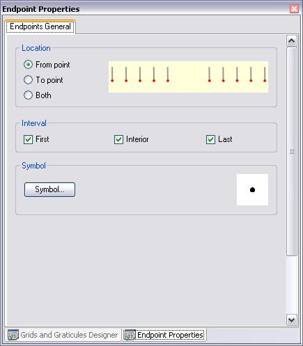
Endpoints can be generated for the following locations of any linear grid feature (segments, grid lines, or ticks):
- From point—Point is created at the beginning of a component.
- To point—Point is created at the end of a component.
- Both endpoints—Points are created at the beginning and end of a component.
In the geodatabase feature class for endpoints, each endpoint has two fields, TEXT_X and TEXT_Y, that store the coordinate location for that point. The coordinate location for the point is in units relative to the coordinate system of its parent component's coordinate system. For example, if the endpoints are generated from a grid line that has an ancillary geographic coordinate system, the x- and y-values will be in decimal degrees. If the endpoints are generated from a grid line that has a primary coordinate system, the x- and y-values may be in meters.
Extent settings determine which endpoint will be created along the line of points. Settings include:
- All—All components have endpoints.
- Corner—Endpoints are only created for the corner you choose.
Corner options include:
- First—Create endpoints for the first linear grid feature.
- Last—Create endpoints for the last linear grid feature.
- Not First or Last—Create endpoints for all linear grid features except first and last.
Refer to the Endpoints area above the Extent area when making these selections. You can see a graphic of where the endpoints are created as you click the various Extent options.
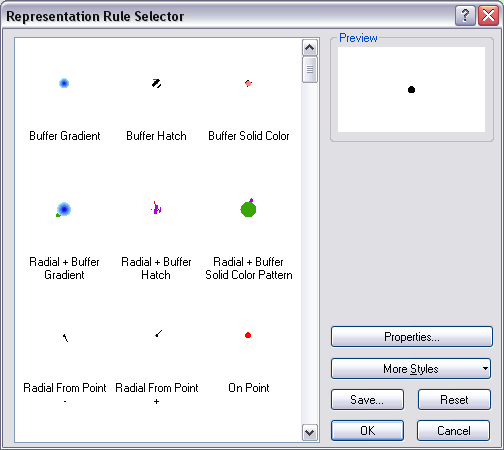
On the Symbol tab, you can choose a symbol from the standard ArcGIS dialog box.
- Start ArcMap.
- Click the Grids and Graticules Designer window button
 on the Production Cartography toolbar.
 - Create or load a grid.
- Right-click a Segments, Gridline, or Ticks component in the tree view and click Add > Endpoints.
The Endpoints component is added to the tree view.
- Right-click the Endpoints component in the tree view and click Properties.
The Endpoints Properties tab appears.

- Choose a location option in the Location area.
- Choose an interval option in the Interval area.
- Click Symbol.
The Representation Rule Selector dialog box appears.

- Set the appropriate symbol and modify the properties as necessary.
- Click OK.