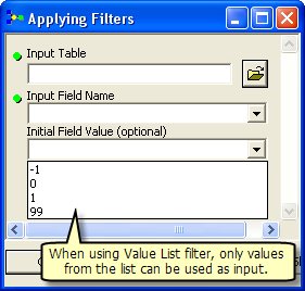
Parameter filters are used to limit or restrict the input values or data that can be specified for a model tool parameter. For example, a Value List filter can be used so that only values from a list can be specified for the parameter.

There are six types of parameter filters. The type of filter that can be used depends on the data type of the parameter.
- Value List—A list of predefined keywords.
- Range—A range of valid numeric values. The range is inclusive, meaning the minimum and maximum values are valid choices.
- Feature Class—A list of allowable feature class types: point, multipoint, polyline, polygon, multipatch, sphere, annotation, and dimension.
- File—A list of valid file extensions, such as .txt (simple text file) or .csv (comma-separated value).
- Field—A list of allowable field types: short, long, single, double, text, date, OID, geometry, BLOB, raster, GUID, global ID, and XML.
- Workspace—Types of workspaces that are allowed for the model parameter.
For most parameters, there is only one filter type that can be used. For parameters with a numeric data type (long or double), Value List or Range filters can be used.
Feedback on this topic?