Available with 3D Analyst license.
Once you've added data to a 3D view, you might also want to add a 3D graphic. Graphics can be created directly in ArcScene and ArcGlobe or copied and pasted from ArcMap.
In ArcScene, you can interactively digitize point, line, polygon, and text graphics. By default, these graphics are digitized as a single entry. For example, the New Marker button must be clicked each time you want to digitize successive point graphics.
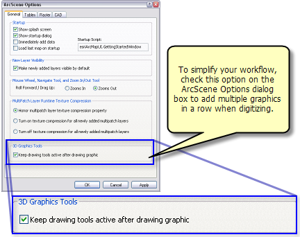
You can also choose to digitize multiple graphics while using any of the graphic tools by simply clicking Customize > ArcScene Options and clicking the General tab. Then check the Keep drawing tools active after drawing graphic option as shown in the screenshot below.

Many 3D graphics capabilities are exposed on the Globe 3D Graphics toolbar in ArcGlobe and the 3D Graphics toolbar in ArcScene. For simplicity, the term 3D Graphics toolbar is used to represent both toolbars. Unique usages will be clearly differentiated between the two applications, where applicable.
Instructions for digitizing each of the 3D element types, including how to copy and paste from ArcMap, can be accessed from the links below .