You may find that your bathymetry data would be better managed in multiple BIS geodatabases. You can manage connections to BIS geodatabases with the Manage Connections tool.
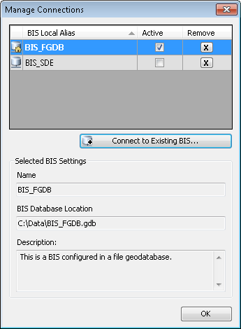
The Manage Connections tool lists the BIS geodatabases that you are currently managing and displays their BIS settings information. In the Manage Connections dialog box, you can activate a particular BIS geodatabase, remove a BIS geodatabase from your management list, and connect to a BIS geodatabase stored locally or on your network. The tool recognizes the enterprise and file geodatabase types.
You can connect to an existing BIS geodatabase using the Manage Connections tool.
- Start ArcMap.
- On the main menu, click Customize > Toolbars > Bathymetry.
-
Click the Manage Connections button
 on the Bathymetry toolbar.
The Manage Connections dialog box appears.

- Click Connect to Existing BIS.
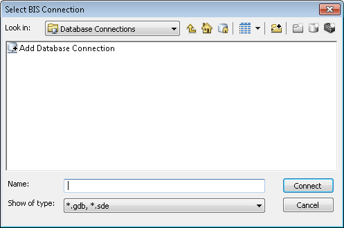
The Select BIS Connection dialog box appears.

- Navigate to and select the BIS geodatabase connection to which you want to connect.
You can select enterprise or file geodatabases.
- Click Connect.
The new BIS geodatabase connection is listed in the Manage Connections dialog box.
- Click OK.