Available with Standard or Advanced license.
Multipart, donut, and island parcels can be created and maintained in the parcel fabric. Multipart and donut polygons can also be migrated to the parcel fabric using the Load A Topology To A Parcel Fabric geoprocessing tool.
Multipart parcels
Multipart features are composed of more than one physical feature that only references one set of attributes. Multipart parcels are composed of more than one polygon and reference one set of attributes. An example of a multipart parcel is a single parcel that is split by a right-of-way such as a road.
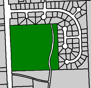
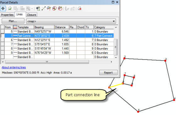
Multipart parcels are automatically created in the parcel fabric when disjoint parcels are merged. A part connection line connects the disjoint parcels. You can also manually create multipart parcels by traversing in a part connection line between closed parcel traverses.
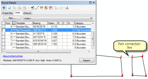
The Load A Topology To A Parcel Fabric geoprocessing tool will migrate disjoint, multipart polygons as multipart parcels if the polygon features are multipart features. Part connection lines are automatically created during the data migration process.
Donut and island parcels
Donut parcels are polygons that have an interior hole. Island parcels are polygons that fill the interior hole of a donut parcel. An example of a donut parcel would be a parcel containing a lake. An example of an island parcel would be a parcel surrounded by a right-of-way parcel such as a road.
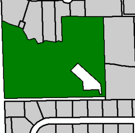
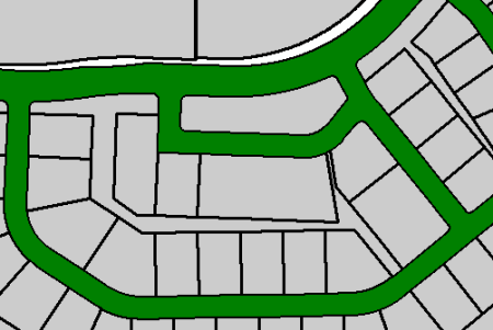
Donut parcels are automatically created in the parcel fabric when disjoint, overlapping parcels are used to create remainder parcels. A part connection line connects the interior donut hole to the surrounding parcel. You can also manually create a donut parcel by traversing the outer ring parcel and using a part connection line to connect to and traverse the inner ring parcel.
The Load A Topology To A Parcel Fabric geoprocessing tool will migrate donut polygons as donut parcels if the polygon features are donut features. Part connection lines are created during the data migration process.