ArcGIS Desktop

  • ArcGIS Pro
  • ArcMap

  • My Profile
  • Help
  • Sign Out
ArcGIS Desktop

ArcGIS Online

The mapping platform for your organization

ArcGIS Desktop

A complete professional GIS

ArcGIS Enterprise

GIS in your enterprise

ArcGIS Developers

Tools to build location-aware apps

ArcGIS Solutions

Free template maps and apps for your industry

ArcGIS Marketplace

Get apps and data for your organization

  • Documentation
  • Support
Esri
  • Sign In
user
  • My Profile
  • Sign Out

ArcMap

  • Home
  • Get Started
  • Map
  • Analyze
  • Manage Data
  • Tools
  • Extensions

ArcGIS Maritime properties

When working with ArcGIS Maritime, you can configure how certain tools behave and what rules they should use. These properties are set once after ArcGIS Maritime has been installed. These properties are not to be set again unless using different database connections or a new version of ArcGIS Maritime is installed. The following properties are set on the Nautical Properties pane of the Production Properties dialog box.
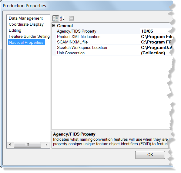
Production Properties dialog box

The following table shows which settings are configured by the install and which settings require a user input. All of the settings can be changed if necessary.

Property Description Default setting Configuration required

Agency/FIDS Property

Indicates what naming/numbering convention features use when they are created.

4E/43110

Yes

Product XML file location

Location where all the product XML configuration files are stored.

Populated based on installation location

No

SCAMIN XML file location

The location of the XML file that defines the set of rules used by the SCAMIN tool.

  • For ENC production, it is populated automatically based on the installation location.
  • For IENC production, you must set the property to the SCAMIN_IENC_2_3_EU_Sample.xml or the SCAMIN_IENC_2_3_US_Sample.xml depending on whether you want to use US based SCAMIN mapping, or EU based SCAMIN mapping.

No

Scratch Workspace Location

During certain processes like creating a Chart product, a scratch workspace location is needed when building the specific output.

Populated based on installation location

No

Unit Conversion

Unit conversion and rounding rules allow data values to be stored as different units without the loss of information when imported and/or edited in the geodatabase.

N/A

No, unless your organization requires values to be converted to different units.

Note:

This property is present only when there are unit conversion tables in your product library.

The ArcGIS Maritime properties and options or descriptions for setting them.

Related topics

  • Configuring the SCAMIN file

ArcGIS Desktop

  • Home
  • Documentation
  • Support

ArcGIS

  • ArcGIS Online
  • ArcGIS Desktop
  • ArcGIS Enterprise
  • ArcGIS
  • ArcGIS Developer
  • ArcGIS Solutions
  • ArcGIS Marketplace

About Esri

  • About Us
  • Careers
  • Esri Blog
  • User Conference
  • Developer Summit
Esri
Tell us what you think.
Copyright © 2021 Esri. | Privacy | Legal