Available with Data Reviewer license.
If you want to save your results before ending the session, click the Reporting tab on the Positional Accuracy Assessment Results dialog box. When the results are saved to a text file, you can do additional updating to the features in the evaluation layer.

- Start a PAAT session.
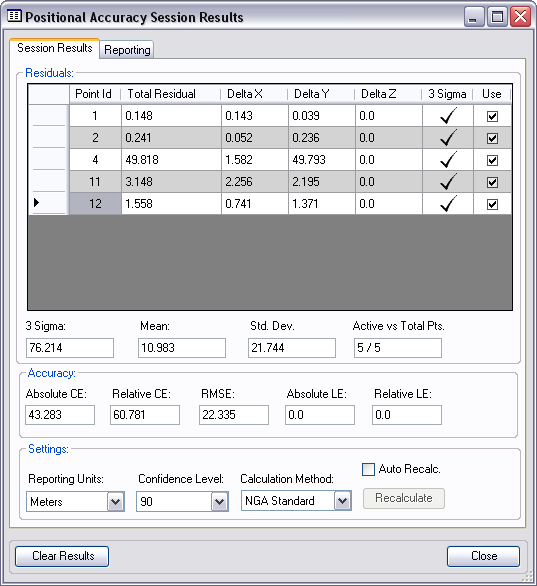
- Click the Show Results button
 on the Positional Accuracy Assessment toolbar.
The Positional Accuracy Session Results dialog box appears.

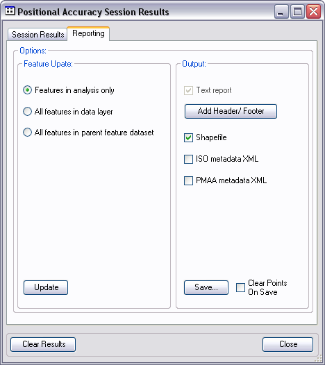
- Click the Reporting tab.

- In the Feature Update area, choose from among the three options if you are evaluating a feature layer.
- Features in analysis only—Update only the features that have been modified or updated in the current session.
- All features in data layer—Update all features in the layer being evaluated.
- All features in parent feature dataset—Update all features in the feature dataset with the accuracy values.
- In the Output area, choose an option or a combination of the options to save the results of the PAAT session.
- Check the Text report check box to generate the output as a text report.
- Click Add Header/Footer to add both or only a header or footer to the report.

- Check the Shapefile check box to create a shapefile that shows the locations of the point readings.
- Check the ISO metadata xml check box to output the results of the session as an XML file that is ISO metadata compliant.
- Check the PMAA metadata xml check box to output the results of the session as an XML file that is compliant with PMAA metadata.
- If you have clicked Add Header/Footer, do the following:
- Type the text you want to appear in the header of the report in the Header text box.
- Type the text you want to appear in the footer of the report in the Footer text box.
- Click OK.
- Once you have selected the options, click Save.
The Save results for Positional Accuracy dialog box appears.
- Navigate to the directory in which you want to save the files.
- Type a base name for the files that will be created in the File name text box.
- Click Save.
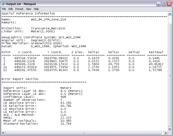
The output options you chose are saved to the location you specified using the base name specified. Also, the text report is displayed in the default text editor for your system.